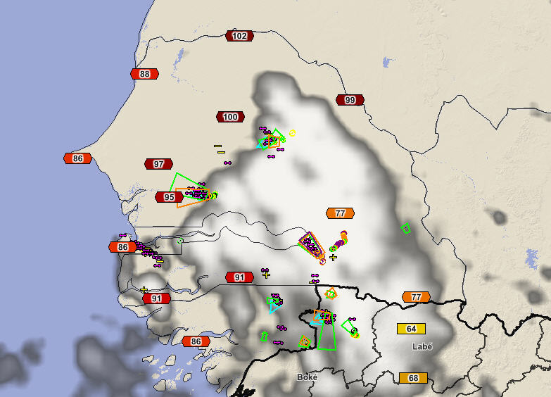
2013 October 11, 16:00 UTC: A westward moving impulse along the Inter-Tropical Convergence Zone (ITCZ) caused a large area of strong thunderstorms to develop this afternoon. The storms were located across northern Guinea and into Senegal and Guinee-Bassau. Storms were moving into a very hot and unstable air mass. The storms were feeding off a very warm and unstable air mass located over the region. Temperatures were over 30C and some near 40C with high humiditiy.
A westward moving impulse along the Inter-Tropical Convergence Zone (ITCZ) is shown here with infrared satellite, and lightning data. Storms were moving into a very hot and unstable air mass.
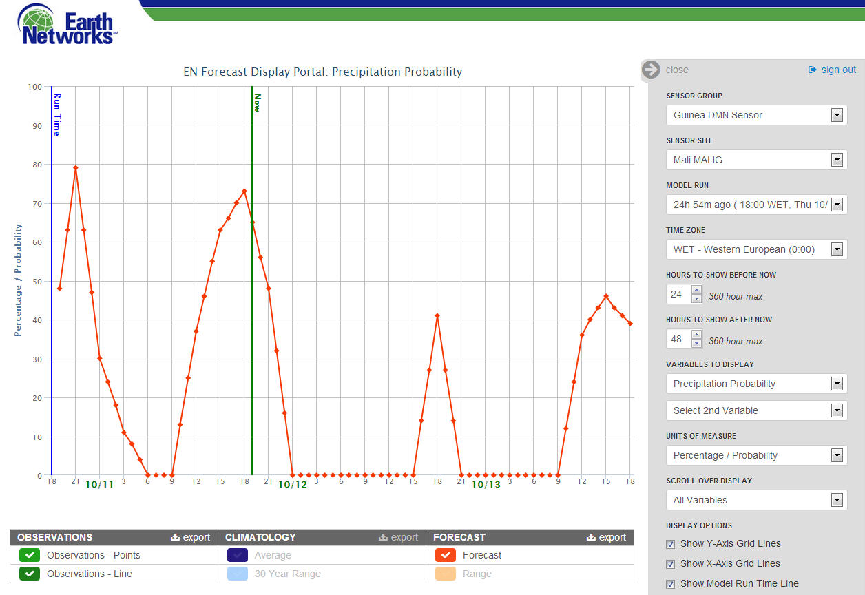
ENcast hourly forecast shows that the rainfall experienced this afternoon in Mali was well forecasted yesterday.
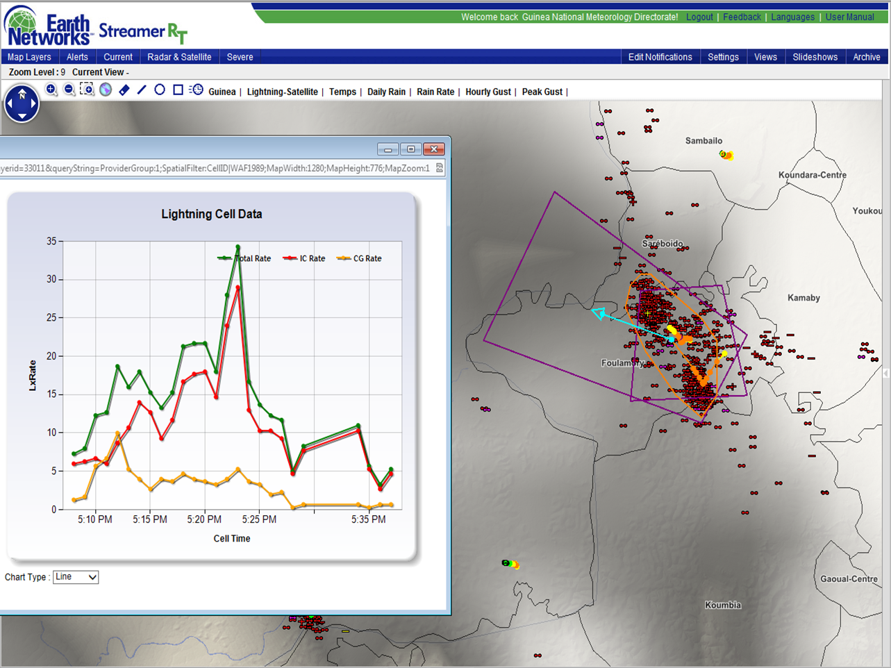
Storm intensity is shown through a graph of lightning rate for a storm in NW Guinea. Rates were strong enough to cause a Dangerous Thunderstorm Alert to be issued.
The Guinea Total Lightning Detection System shows the speed, intensity and direction of strong storm.
-
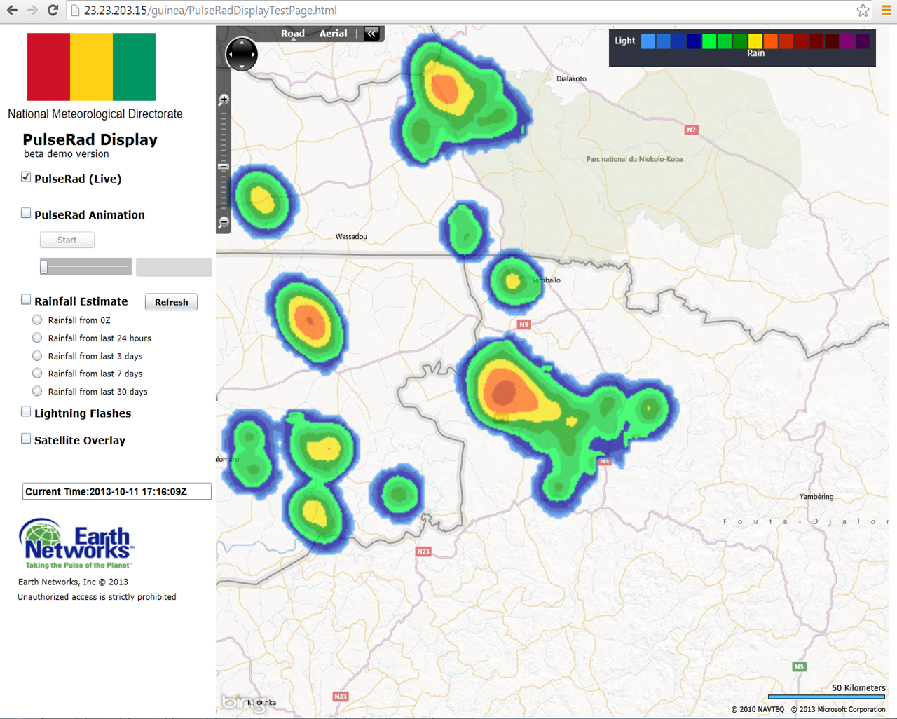
Simulated radar using the total lightning data is able to depict the strongest storms as they move out of northern Guinea into Senegal and Guinee-Bassau.