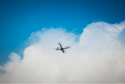
What’s that in the sky? Get ready to see more drones (and data)
This summer, Business Insider release their latest drone market forecast and it indicates that industry growth is still robust. In fact, Business Insider predicts the sales of drones to surpass $12 billion with growth across all three major segments of the industry: Consumer, commercial, and government.
According to the U.S. Federal Aviation Administration (FAA) the number of drones in the U.S. will increase dramatically over the next five years. The commercial drone fleet reached about 42,000 by the end of 2016 and the FAA estimates that it will grow to at least 442,000 by 2021.
With more companies adopting drone technologies and more pilots to fly them, one implication of this growth is the data required to keep the industry operating at the highest level. Gathering and analyzing different data sets will be key for drone operators to successfully execute missions moving forward.
A Need for Actionable Data
It’s becoming more evident that the drone industry needs to identify the core actionable datasets it needs to support its growth. What is actionable data? Actionable data is information that provides insights that can be acted upon or gives enough insight into the future that the actions that should be taken become clearer to decision makers. Basically, data for the sake of data isn’t going to help the drone industry (or any growing market, for that matter.) What the marketplace needs areare actionable data.
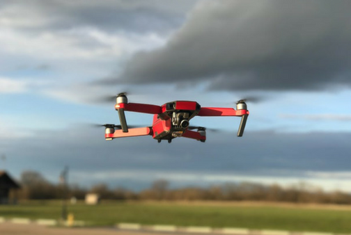
Actionable data integrated into easy-to-use tools optimizes drone operations from mission planning to mission analysis. One such data set perfect for drone operators is weather data. As organizations move towards deploying drones for commercial applications ranging from delivery of goods to consumers to performing infrastructure inspections, one of the most significant challenges to emerge is the need for advanced weather data. This is because wind speed and direction can greatly affect a drone’s flight.
Let’s take a look at five ways weather forecasting data in low-altitude areas (under 400 feet) is key for drone operators.
1. Planning Missions
When it comes to planning drone missions, knowing the weather at the exact altitude(s) you’ll be flying is extremely important. Wind direction can speed or slow an unmanned vehicle, cooler temperatures can have an adverse impact on battery life, and high wind speeds could blow drones completely off course.
Knowing the forecast for the operating area means that operators can plan which days are most favorable for their mission. This information also helps them calculate trajectory, range, and other flight parameters more effectively.
2. Optimizing Mission Duration
Weather data like wind speed and direction also helps drone operators maximize drone flight duration. With this information, operators can define flight paths and elevation to help accommodate battery life and complete missions within a drone’s operating capacity. If a certain air stream will prevent the drone from having enough speed to complete its mission, operators can postpone the mission or make adjustments to optimize.
3. Protecting Assets
Damage and deterioration are, unfortunately, two common issues in the drone community. Inexperienced flyers, obstacles, and even severe weather are all causes that can affect drone hardware. By understanding what weather conditions are going to affect flight at different altitudes, operators can plan, adjust, and reschedule missions to protect expensive drone equipment.
Advanced weather data providers will geofence areas with severe weather to help keep hardware safe. This also helps operators to ignore unreasonable and risky flight paths from the get-go.
This information goes beyond just protecting drones. Actually, this identifies a key use for drones which is assessing damage in hard to reach areas. This will especially be helpful for insurance companies.
4. Analyzing Inspections
One of the greatest impacts weather data is expected to have on the drone market is in analyzing missions. With historical and current weather data, operators can correlate weather conditions against images they are capturing with the drone to see if weather could be a factor in deteriorating infrastructure or crops, for example. Going forward, operators can have a better understanding of which weather situations affect infrastructure. This helps them proactively schedule an inspection mission after a defined weather event occurs.
5. Assessing Non-Connected Areas
A harsh reality of the drone industry is that operations are often required in non-connected areas. For missions in remote areas with limited connectivity, utilizing forecasts provides operators with weather information while traveling to mission sites and for planned mission times. This is a great benefit for operators around the world.
Drones and Severe Weather: 2 Case Studies
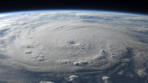
It's true that severe weather and high winds can impact drone operations. But did you know that severe weather is also often the cause of drone missions in the first place?
When Hurricane Harvey hit Houston and the surrounding areas, drones were able to fly over the city and assess the widespread damage only once conditions were safe. According to Justin Herndon, a spokesman for Allstate, Harvey was “the widest scale event that we’ve used drones for to date.” Farmers Insurance, another major property insurance company, also used drones. They captured aerial images of the insured property. This helps protect employees because they no longer have to climb on damaged roofs or debris.
<
The above video shows the drone footage Verizon captured after Hurricane Harvey. Using drones to assess damage to critical telecommunications infrastructure is nothing new for Verizon. The previous year, Hurricane Matthew flooded much of Florida so badly that many roads were completely impassible. This was true even days after the storm moved on. Verizon flew drones over the affected area to check cellular site locations for both connectivity and damage. This was much more efficient than driving a boat with technicians to check each tower individually.
In both cases, using drones to take pictures ended up being faster, safer, and cheaper for insurance companies and telecom providers alike. The interesting relationship between severe weather and drone operations will only strengthen with time.