<img height="1" width="1" style="display:none" src="https://q.quora.com/_/ad/c23eff63613649339a864dbd6dedfb92/pixel?tag=ViewContent&amp;noscript=1">

Afternoon Storms Push Toward Coast Dropping Temps and Rainfall

Oct 01, 2013 Blog . Africa

SHARE

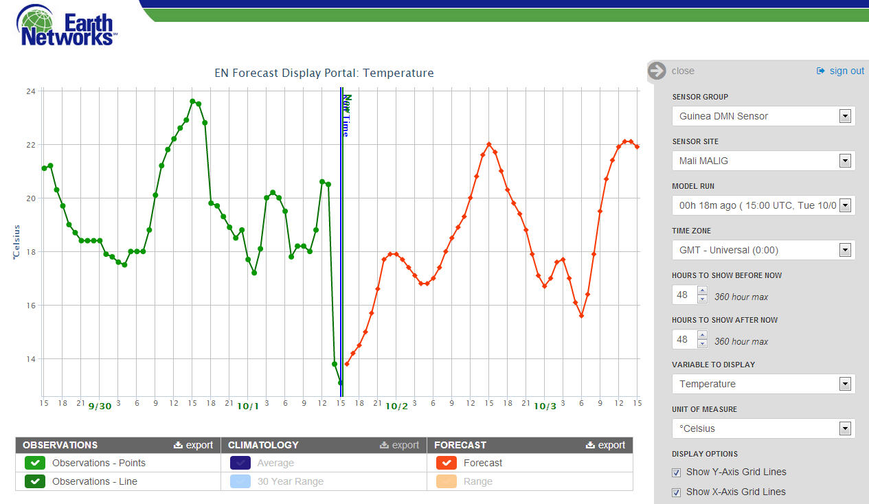
1 October 2013, 15:15 UTC: A line of storms that developed over Haute Guinee and Moyenne Guinea has been steadily moving westward throughout the afternoon. The storms moved through Mali between 13:00 and 15:00 today and dropped temperatures from 20.5C to 13.1C. The storms also dumped from 10-40 cm of rain over roughly 90 minutes.

Graph shows temperature profile for Mali over the last 2 days (green) with precipitous drop occurring this afternoon as storms rolled through. Forecast shows temperatures will rebound some before dark.

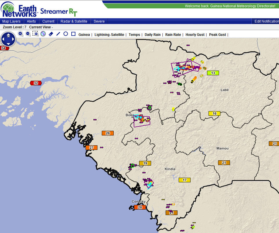
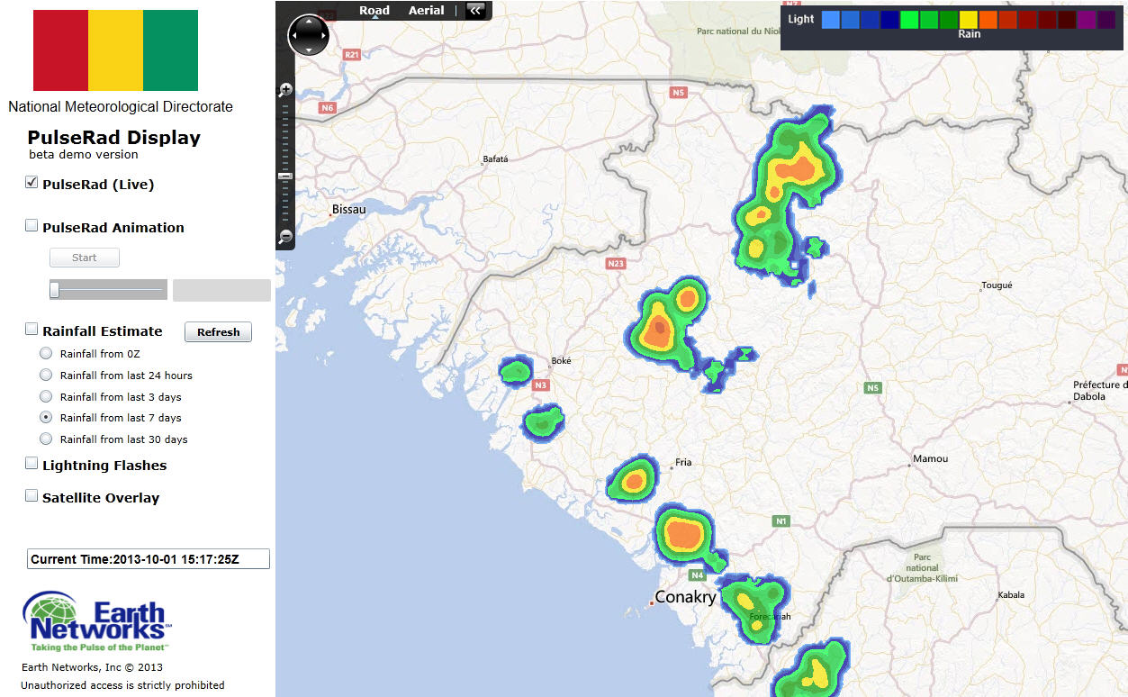
Visualization system shows lightning associated with storms across the western half of Guinea. Purple polygons indicate areas under Dangerous Thunderstorm Alerts for heavy rain and frequent lightning along with some gusty winds.
Radar also showed a line of storms forming inland along a sea breeze front in Basse Guinea. These storms will continue to develop and drift slowly west. The additional storms moving out of the highlands to the east could act to enhance these coastal storms and create even more intense displays of lightning and rainfall after sunset.
PulseRad proxy radar shows strong storms moving out of the highlands as well as a line of sea breeze thunderstorms in western Guinea.