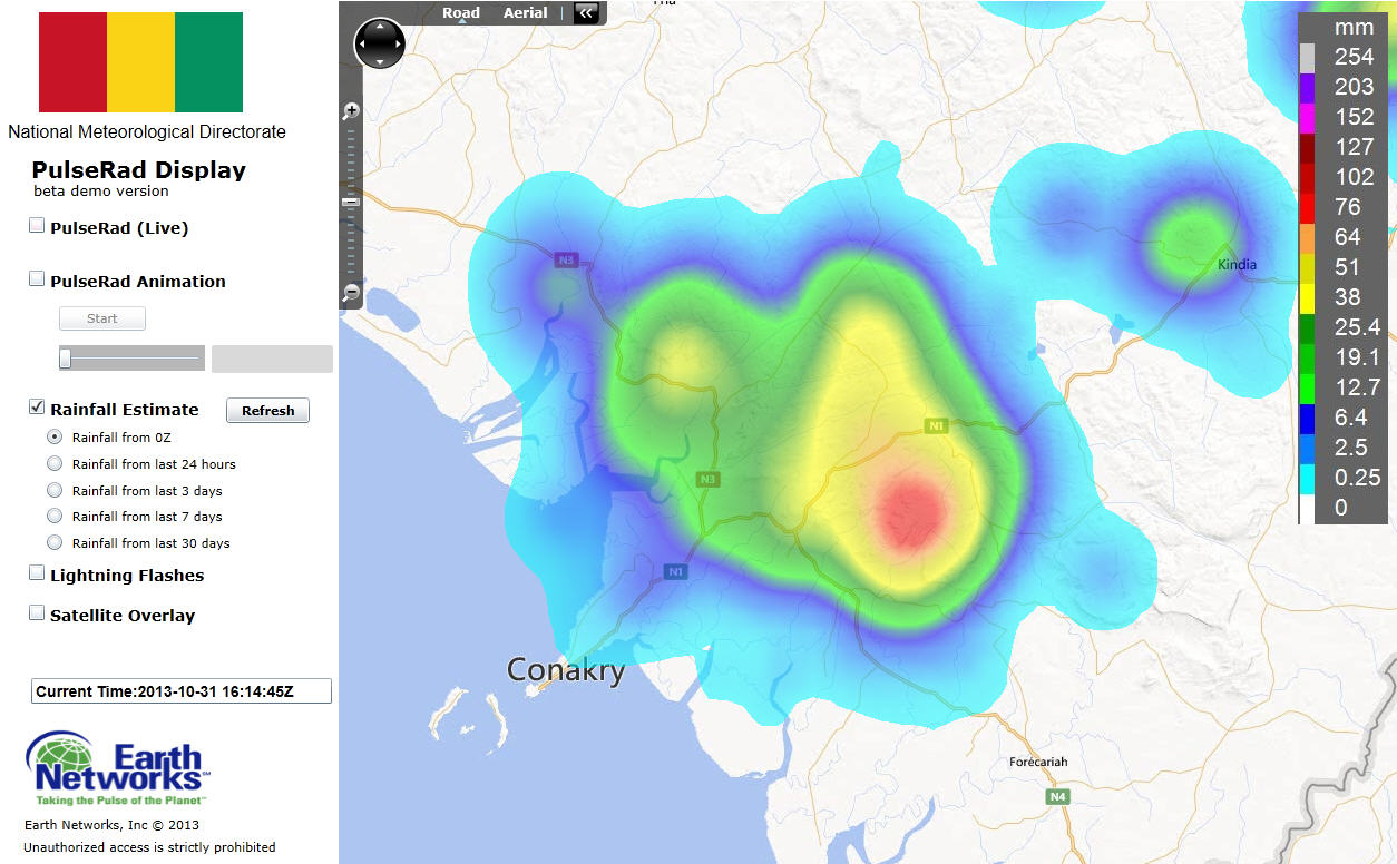
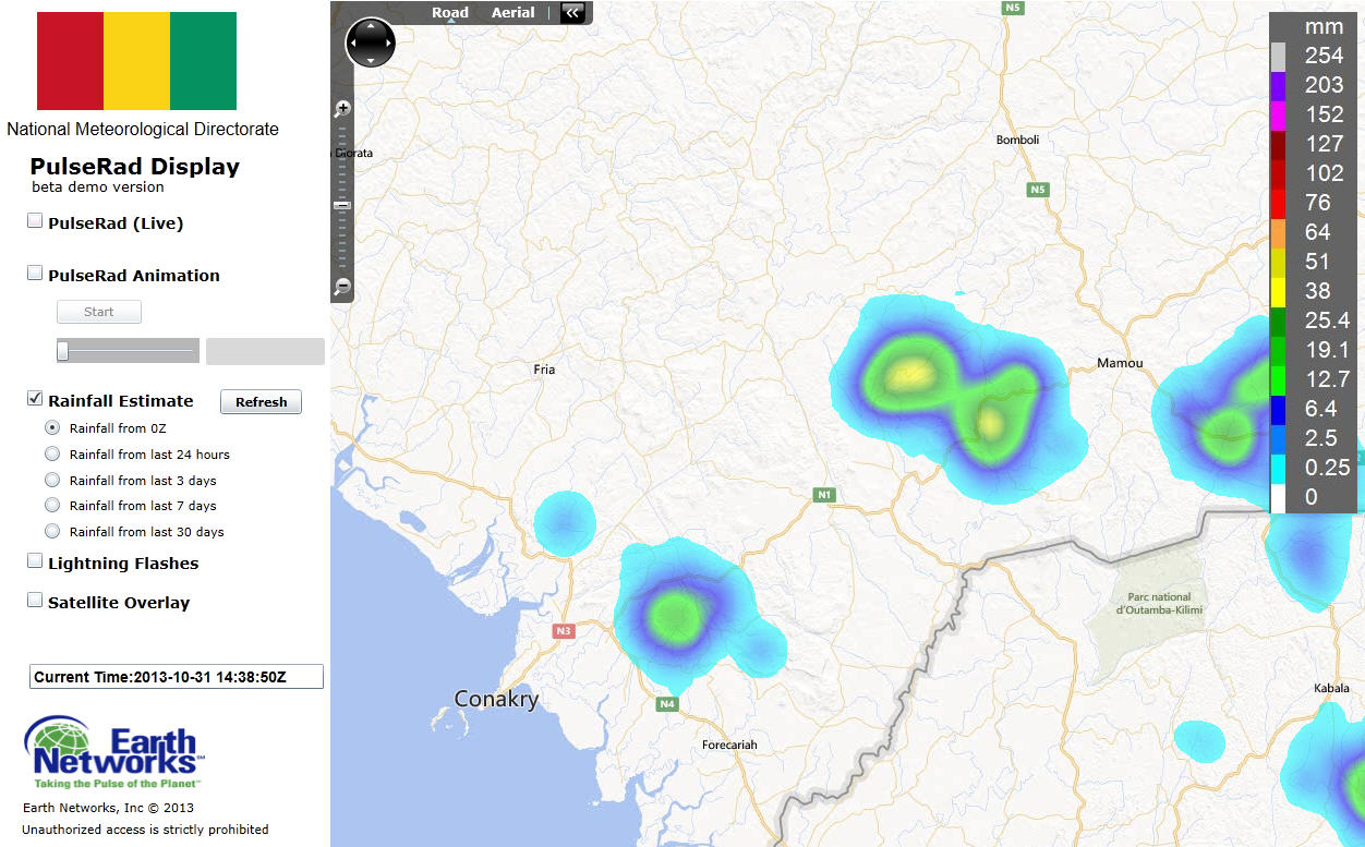
Update – 15:30 UTC: Guiinea meteorologists continue to monitor a strong storm between Conakry and Kindia near the N1 highway. PulseRad radar estimates indicated that 75-100 mm of rain has fallen in the last 60-90 minutes. Recently, winds have gusted to 90 km/hr in Conakry. Flash flooding is occuring in this region. Dangerous Thunderstorm Alerts continue to be in effect for this storm.
31 October 2013, 14:30 UTC: Guinea meteorologists are once again tracking the development of afternoon thunderstorms across Basse Guinea, the western region of the country. Today, storm development has been less due to drier air in the mid-levels across the northern and northwestern part of the country. More significant moisture is evident in the southwest and this is where scattered storms have begun to develop. Strong storms have formed in the hills to the northeast of Conakry and near Kindia and Mamou.
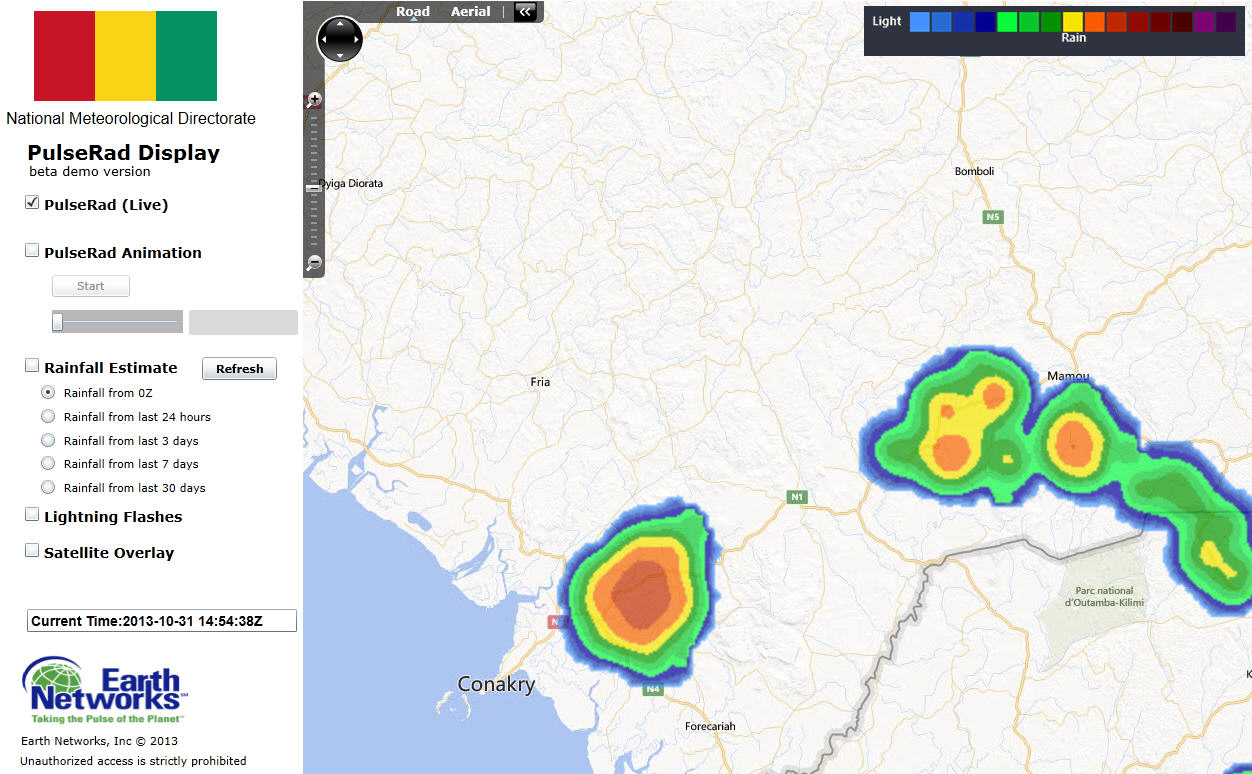
The Guinea Total Lightning Detection System has tracked the development of two very strong storms along the N1 highway running between Conakry and Mamou. The system has generated Dangerous Thunderstorm Alerts for these storms for dangerous lightning, very heavy rain and gusty winds.
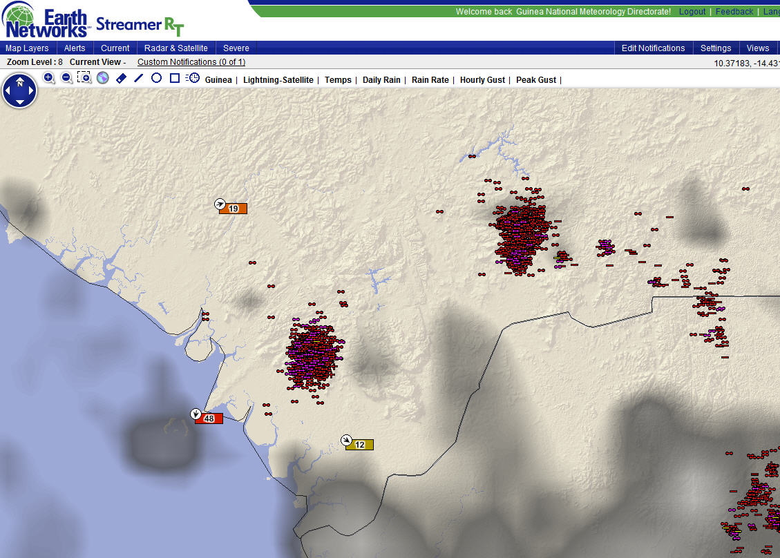
PulseRad, simulated radar generated from precipitation rate estimates base on the total lightning detection was showing some extreme rainfall rates. The storms were moving very slow and rainfall totals in the last 30-60 minutes have been locally heavy from 25 – 40 mm/hr.
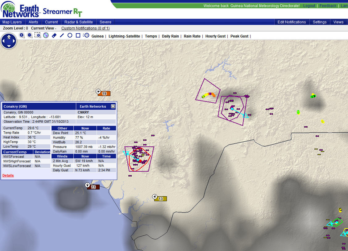
Just after 2:30 p.m. local time in Conakry a strong outflow wind gust was observed in the city – gusting to 73 km/hr.
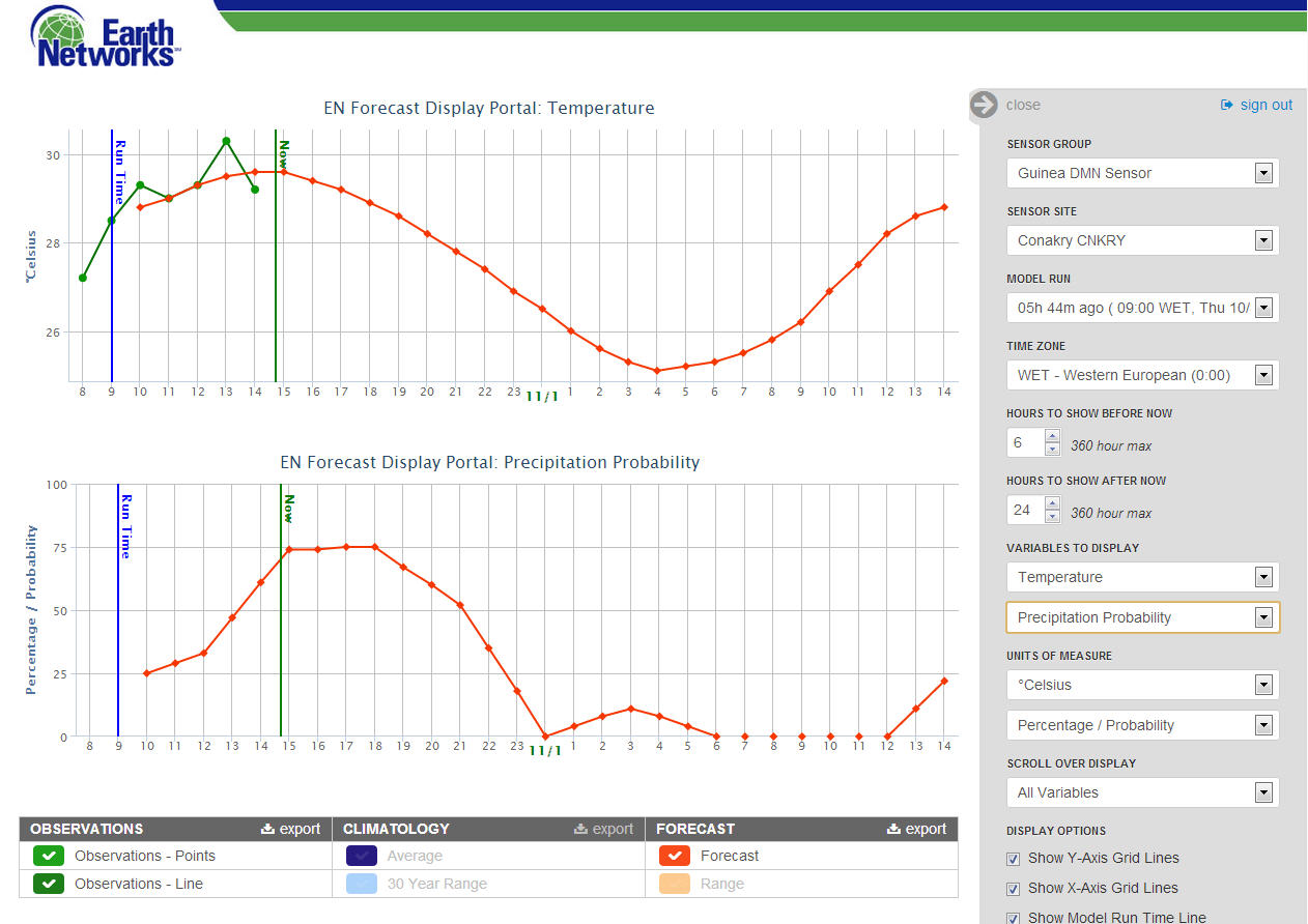
Hourly updating forecasts using the live station data indicate that precipitation probabilities will be high through the afternoon due to the slow moving nature of the storms.