<img height="1" width="1" style="display:none" src="https://q.quora.com/_/ad/c23eff63613649339a864dbd6dedfb92/pixel?tag=ViewContent&amp;noscript=1">

Widespread Storms Drench Sierra Leone, Liberia

May 20, 2014 Blog . Africa

SHARE

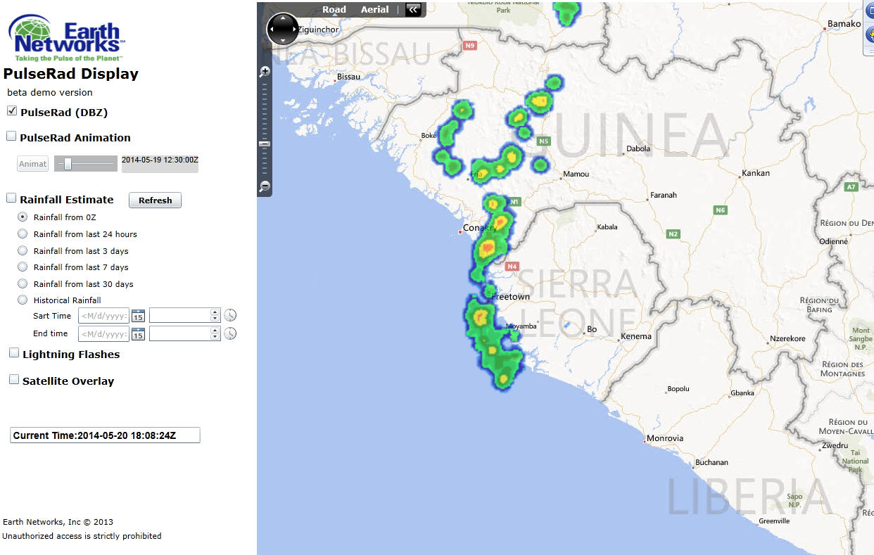
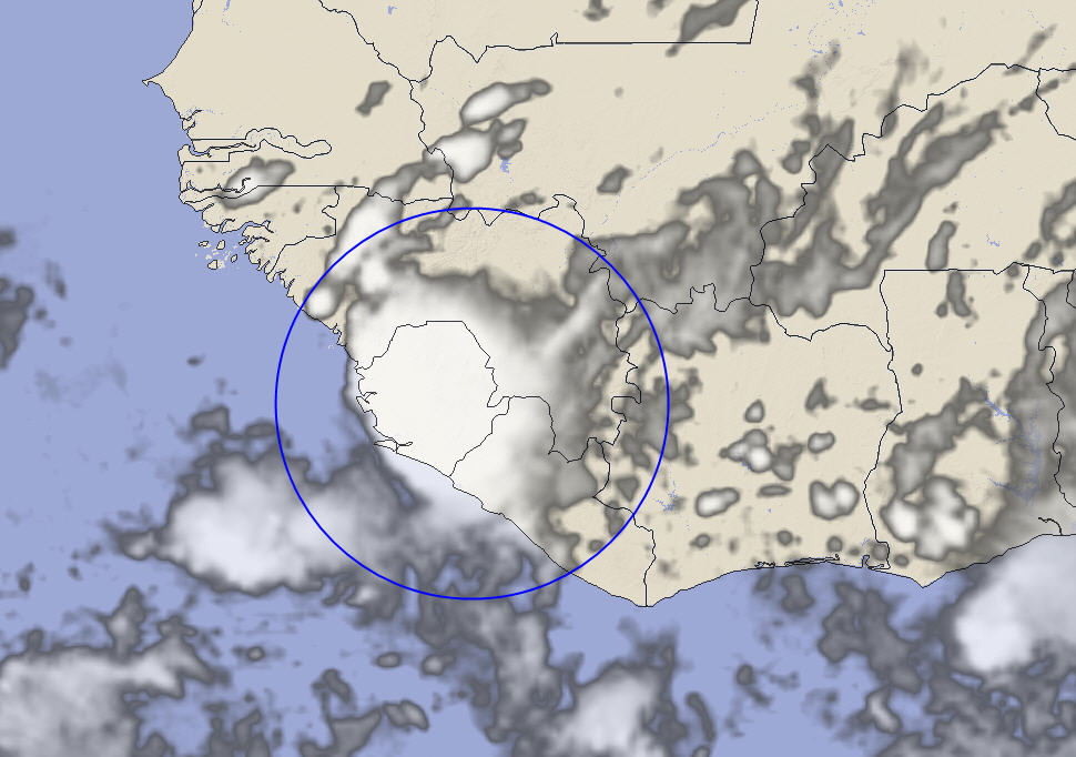
20 May 2014, 1800 UTC: An upper level area of instability along the Intra-tropical Convergence Zone (ITCZ) moved across the western coast of Africa today, triggering an active and strong area of thunderstorms early in the afternoon.

The PulseRad system displays the very strong storms early in the afternoon as they moved into eastern Sierra Leone and over northern Liberia.
The infrared satellite image from 18:00 UTC shows an impulse of energy along the ITCZ in western Africa.

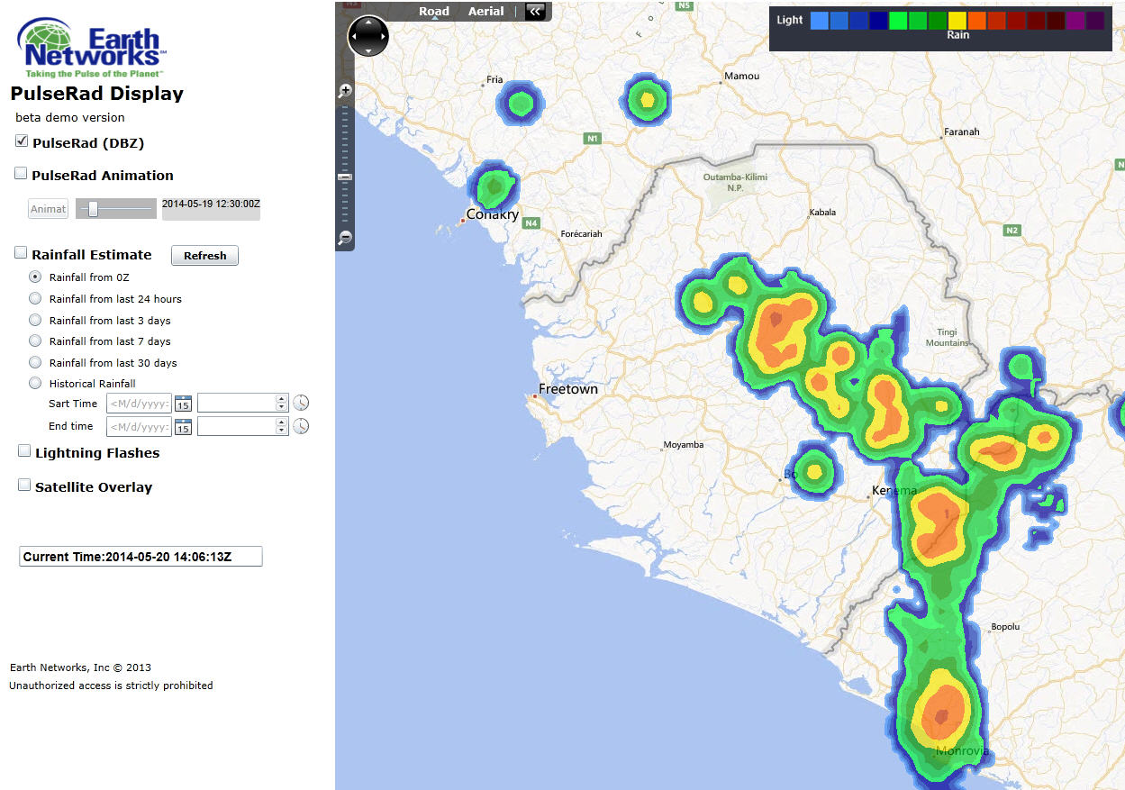
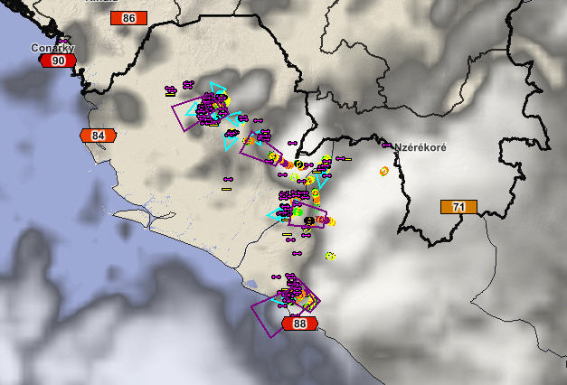
The storms were tracked by the Guinea Total Lighting Network as they developed and increased in intensity. The alerting system, triggered by the intense rate of lightning detected, issued warnings for parts of interior Sierra Leone for storms producing very heavy frequent lightning (rates over 40 flashes/min) and intense downpours of rain.

The Total Lightning Network generate Dangerous Thunderstorm Alerts over Sierra Leone due to the very frequent lightning detected by the system.

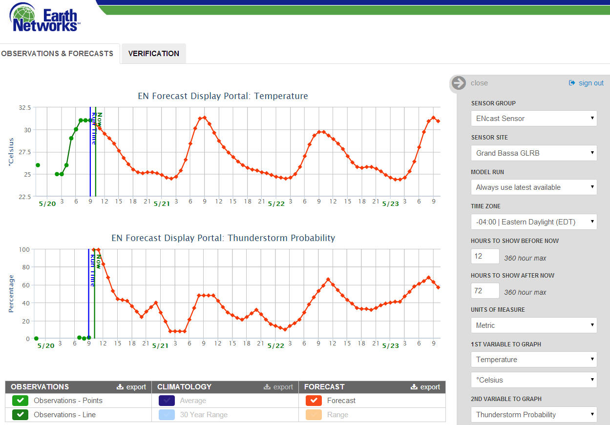
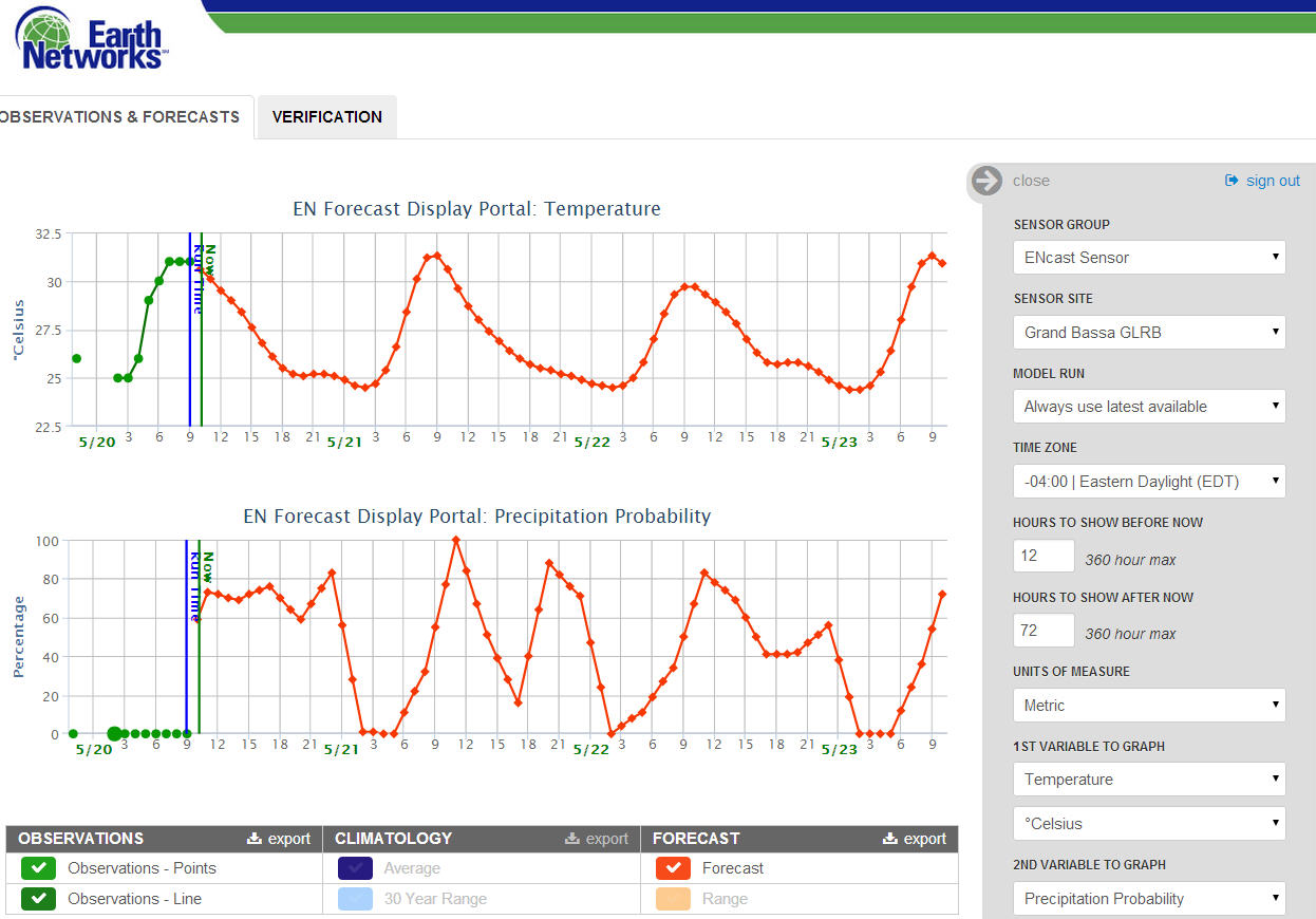
The storms had been well forecasted by the ENcast forecast system. Probabilities for thunderstorms and rainfall were over 50% yesterday and increased to near 100% by late morning today. The ENcast forecast for Monrovia in Liberia indicated very high threats for storms today and over the next several days.

The ENcast forecast engine shows the forecast for temperature and thunderstorm probabilities over the next three days. Very high probabilities for thunderstorms were in the forecast during the afternoon.
The ENcast forecast engine shows the forecast for temperature and thunderstorm probabilities over the next three days. Very high probabilities for rainfall were in the forecast during the afternoon.

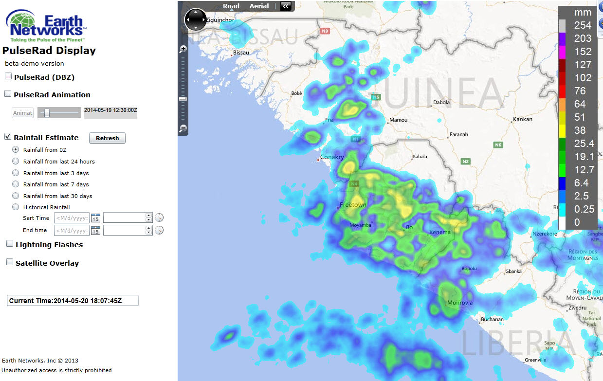
By late afternoon and early evening, the storms had moved to the coast and started to develop in southwest Guinea, but the PulseRad radar system tracking accumulate rain was indicating the storms had dropped significant amounts of rain, specifically in Sierra Leone where 25-50mm of rain was common.

PulseRad shows the strongest storms with the most intense lightning have moved offshore from Sierra Leone by 18:00 UTC.
PulseRad estimated rainfall for the afternoon indicates rainfall totals ranged between 15 and 50 mm of rain over most of Sierra Leone and northern Liberia.